
Implementation Effort
- Requires minimal effort
- Timeline between 2-3 weeks*
* Assuming an agency has an existing, configured AASHTOWare Safety instance and all required data

Our Customer Success team helps agencies turn crash data into actionable insights. The processes below show how they’re making their communities safer.
This document provides an overview of how the Georgia Department of Transportation integrated Esri land data into AASHTOWare Safety as a filter.
* Assuming an agency has an existing, configured AASHTOWare Safety instance and all required data


The Georgia Department of Transportation (GDOT) needed to provide more context for crash data; users could query rural or urban-area crashes, but more precise crash location information was needed.
To accomplish this, GDOT partnered with AASHTOWare Safety and used ESRI Land Cover data, which classifies the developed status of land, to build the Land Cover filter into the applications. This filter allows users to filter and view land cover classification information for specific roadways and crashes. The land cover classification for the midpoint of a segment applies to the entire segment.
Land cover data provides a critical environmental context that affects crash patterns and
severity. Built areas indicate higher pedestrian traffic and urban driving conditions, whereas tree-lined segments may have visibility issues or fixed-object hazards.
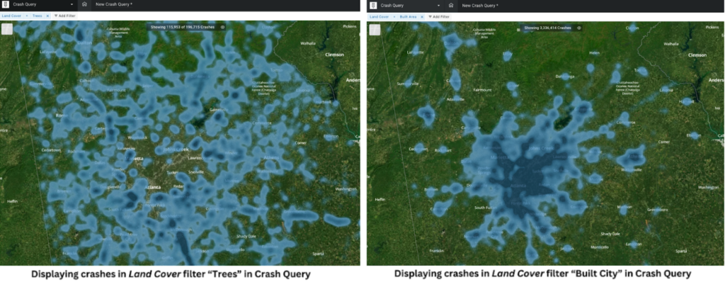
This data allows users to apply context classifications to their analysis. With this filter, users can be more specific when narrowing their crash population. For example, instead of simply querying “rural” area crashes, users can now search for Rural Built Area crashes to see the more developed areas within rural areas.
The ESRI data used to create this filter categorizes land classifications in 10-meter sections. The classifications available for each section are:
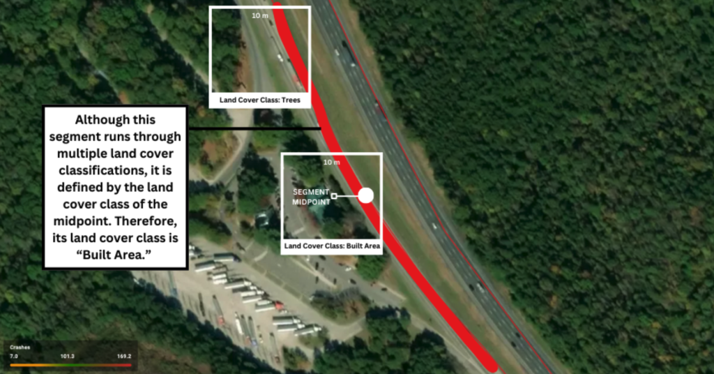
This classification enables analysts to identify location-specific risk factors rather than treating all parts of a rural or urban area as the same.
More information on this topic can be found below: